I'm now commuting from Katy to an office building on the North I-10 frontage road and Kirkwood. It's 19.5 miles each way and in many ways encompasses the best and worst of bike commuting in Houston. With the shared use paths on the Bayous,George Bush & Terry Hershey parks, roughly 18 of the 19.5 mile commute is car free and safe as can be. It's a scenic ride where I've seen deer, armadillo, rabbits, squirrels, alligators, coyotes, opossum, snakes, cygnets, swans, vultures, hawks, ducks, etc. 18 really great commuting miles.
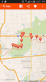 |
| Route Using Kirkwood Heading North |
The other 1.5 miles or so isn't as great. If I take Terry Hershey East to Kirkwood (screen shot above) I then travel North on the Kirkwood "bike lane". This designated bike lane is maybe two feet wide and usually filled with debris. The painted lane is faded and almost nonexistent in many spots. It's the type of bike lane that is more dangerous than good.
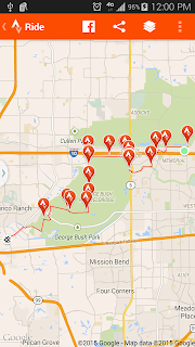 |
| Commute Using Terry Hershey Park North of I-10 |
If I take Terry Hershey North of the I-10 (screen shot above), I ride on the sidewalk of the I-10 frontage road like a dork. In the morning I'm going against traffic and in the evening constantly looking over my shoulder to make sure I don't get slammed by a right turning car. I then cut up Eldridge for a block, again dorking it on the sidewalk, to get to Dairy Ashford and another 2 foot bike lane, albeit with less debris than Kirkwood. This bike lane takes me to another off street shared use path at the Addicks Reservoir. The weird thing is that heading East on Dairy Ashford there is no way to make a proper left turn onto the shared use path. They built this great path and then also put a concrete median in the middle of Dairy Ashford blocking the path from East bound riders. I end up riding in the painted median, cutting across Dairy Ashford and riding in the gutter against traffic for maybe 50 yards before I can make a left onto the path. In the evening going home heading West the cars lining up to go right on Eldridge end up pinching the 2 foot bike lane. I haven't clipped a side mirror yet but it won't surprise me when I do.
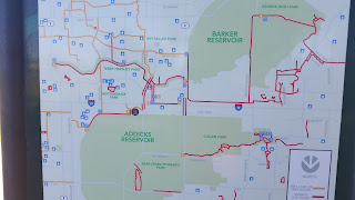 |
| Map of Energy Corridor paths found on Addick Reservoir bike path. North is the bottom of this map |
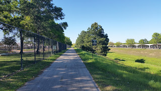 |
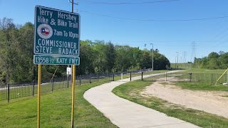
| Start of shared use path at Addicks Reservoir just off Dairy Ashford. I need to take a photo of the jacked up median on Dairy Ashford that blocks this entrance |
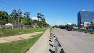 |
| North I-10 frontage road facing East just after exiting Terry Hershey Park |
 |
| Start of Terry Hershey Park North of I-10 |
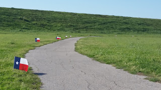 |
| Thought the Texas flags were a nice touch on this day. This is the path around the Barker Reservoir that takes you towards George Bush Park. |
I've seen riders on the street of the I-10 frontage road, and they have my respect, but I just don't feel comfortable sharing the road with that heavy car traffic. Lately with all the rain George Bush Park has been flooded and I haven't been able to use the path. I know I can take city streets to get to work, and in the morning sharing the roads isn't so bad, but in the evening when the roads are crowded and drivers are impatient...I just don't want to do it. Four cyclist have been killed on our streets in the last month and that just chills me. So there you have it. A great workout, wonderful safe ride with beautiful scenery, and some frustratingly not well planned bike lanes on city streets. And Mother Nature throws her twists in as well.


