http://cyclingspacecity.blogspot.com/2017/02/text-when-george-bush-park-flooded.html?_sm_au_=icVqSQJ24nJv1q2P *****
A coworker introduced me to this great tool from the United States Geological Society that notifies you when the path at George Bush Park is flooded. He claims when this chart of the elevation of Barker Reservoir is above 84
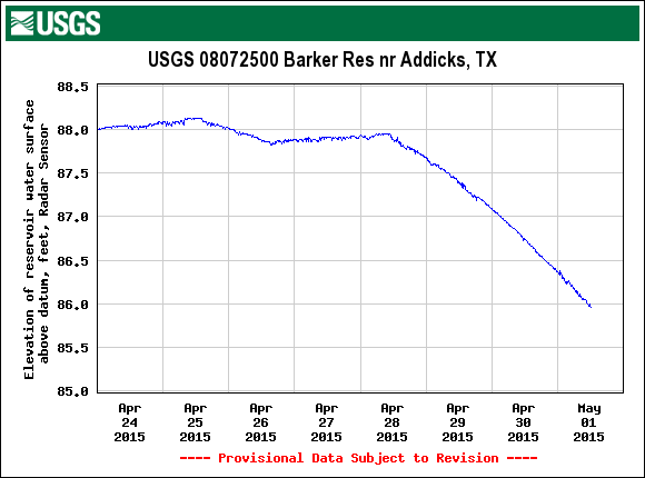
You can set an SMS alert to send a daily update when the water level is above a certain thresh hold, in this case 84 '.
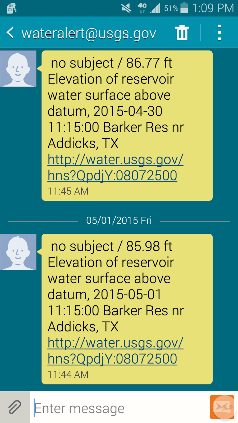
I know the park was flooded yesterday April 30th and if the trend line continues the park should be okay for a Monday commute. I'm looking forward to seeing how accurate this is. Twice last year I packed the panniers and headed out for work to find the park was surprisingly still flooded and return home for a cager commute.
You can find the graph, and sign up for the alerts, here waterdata.usgs.gov The chart you want is third down "Elevation of reservoir water surface above datum, feet, Press Transducer, High Orifice"
