http://cyclingspacecity.blogspot.com/2017/02/text-when-george-bush-park-flooded.html?_sm_au_=icVqSQJ24nJv1q2P *****
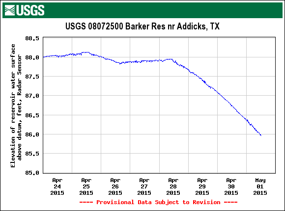
A coworker introduced me to this great tool from the United States Geological Society that notifies you when the path at George Bush Park is flooded. He claims when this chart of the elevation of Barker Reservoir is above 84
You can set an SMS alert to send a daily update when the water level is above a certain thresh hold, in this case 84 '.
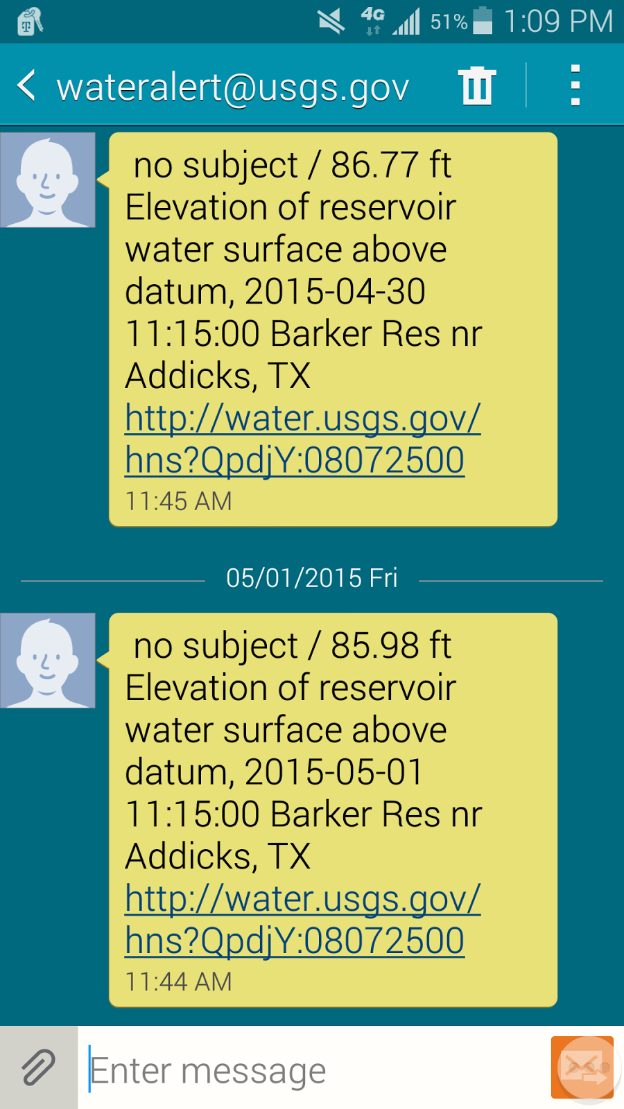
I know the park was flooded yesterday April 30th and if the trend line continues the park should be okay for a Monday commute. I'm looking forward to seeing how accurate this is. Twice last year I packed the panniers and headed out for work to find the park was surprisingly still flooded and return home for a cager commute.
You can find the graph, and sign up for the alerts, here waterdata.usgs.gov The chart you want is third down "Elevation of reservoir water surface above datum, feet, Press Transducer, High Orifice"
THANK YOU!!! This is super helpful.
ReplyDeletekept getting notices every day even when it was dry....I think you meant 84' not 84". Going to change my notifications to 84' and see if that fixes it.
ReplyDeleteThanks. I updated the posting.
DeleteI just rode the trail from I-10 south to the parking lot and back today at about 1 pm, and it was almost completely dry except for one small stretch just south of the bridge where only about a one-foot width of trail was above water.
ReplyDeleteI checked the USGS website just now, and the elevation reading for today is about 84.75 feet, so I can now confirm your co-worker's info that an elevation of 84 feet means that the trail is completely passable.
This comment has been removed by a blog administrator.
ReplyDeleteI just found your blog by searching Google to see if the park was flooded. I'm very new to cycling, but I live right at Highland Knolls and Fry Rd. I'm just now discovering all of the bike trails. I'll keep following your blog.
ReplyDeleteCurrently the bike trail is under 7 or 8 feet of water! (I think I won't hit the trail until July)
ReplyDeleteThe bridge (not the wooden one, the old concrete one) is demolished. They're working on replacing it. Don't know when they'll be finished.
ReplyDeleteI've been meaning to write about this. I called the # on the signs that say the trail is closed and was told 90 days. The guy was pretty helpful and though 90 days was realistic. We'll see
DeleteI've cycled this path for recreation and commuting for a few years. Before the 2016 flood, the unflooded level was 83-84 feet. Now it's about 81-82 feet.
ReplyDeleteAlso, the level reacts to upstream rain differently now than it did a few years ago, I'm guessing due to upstream development. The level spikes faster and higher than it used to. The level reading when the water is rising is somewhat unreliable. The 81-82 feet is for when the level is falling. Note that my 81-82 foot recommendation means the trail is dry. It may be passable at 83 feet, but I stopped doing that, because I got tired of getting my feet and my bike wet.